Old Boundary Marker by Clere Street, Finsbury
Introduction
The photograph on this page of Old Boundary Marker by Clere Street, Finsbury by Milestone Society as part of the Geograph project.
The Geograph project started in 2005 with the aim of publishing, organising and preserving representative images for every square kilometre of Great Britain, Ireland and the Isle of Man.

There are currently over 7.5m images from over 14,400 individuals and you can help contribute to the project by visiting https://www.geograph.org.uk
Old Boundary Marker by Clere Street, Finsbury
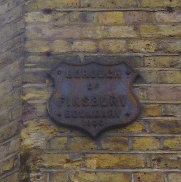
Image: © Milestone Society Taken: Unknown
Municipal Boundary Marker by the UC road, in parish of Finsbury (Islington District), Clere Street EC2, at corner of private road to car park, opposite Fitzroy House. Removed between May 2017 and May 2019. Inscription reads:- BOROUGH OF FINSBURY BOUNDARY {date} Surveyed Milestone Society National ID: MX_FINS07pb
Images are licensed for reuse under creativecommons.org/licenses/by-sa/2.0
Image Location
Latitude
51.523996
Longitude
-0.085253