Old Bridge Marker by Lower Southend Road, Wickford
Introduction
The photograph on this page of Old Bridge Marker by Lower Southend Road, Wickford by Milestone Society as part of the Geograph project.
The Geograph project started in 2005 with the aim of publishing, organising and preserving representative images for every square kilometre of Great Britain, Ireland and the Isle of Man.

There are currently over 7.5m images from over 14,400 individuals and you can help contribute to the project by visiting https://www.geograph.org.uk
Old Bridge Marker by Lower Southend Road, Wickford
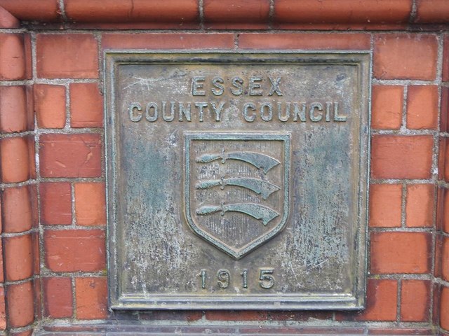
Image: © Milestone Society Taken: Unknown
Bridge Marker by the UC road, in parish of Wickford (Basildon District), on bridge over River Crouch, Lower Southend Road, Northeast side bridge parapet. Inscription reads:- ESSEX COUNTY COUNCIL {coat of arms} 1915 Surveyed Milestone Society National ID: EX_WICK01br
Images are licensed for reuse under creativecommons.org/licenses/by-sa/2.0
Image Location
Latitude
51.614266
Longitude
0.522957