Old Boundary Marker by the B3165, Lanehouse Rocks Road, Weymouth
Introduction
The photograph on this page of Old Boundary Marker by the B3165, Lanehouse Rocks Road, Weymouth by Milestone Society as part of the Geograph project.
The Geograph project started in 2005 with the aim of publishing, organising and preserving representative images for every square kilometre of Great Britain, Ireland and the Isle of Man.

There are currently over 7.5m images from over 14,400 individuals and you can help contribute to the project by visiting https://www.geograph.org.uk
Old Boundary Marker by the B3165, Lanehouse Rocks Road, Weymouth
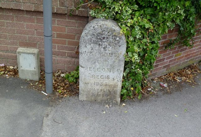
Image: © Milestone Society Taken: Unknown
Parish Boundary Marker by the B3156, in parish of Weymouth (Weymouth and Portland District), Lanehouse Rocks Road, South of junction with Chickerell Road, against wall, West side of road. Inscription reads:- BOROUGH OF WEYMOUTH AND MELCOMBE REGIS 1933 HAMBLIN MAYOR Surveyed Milestone Society National ID: DO_WM04pb
Images are licensed for reuse under creativecommons.org/licenses/by-sa/2.0
Image Location
Latitude
50.609995
Longitude
-2.486139