"Campsie Bridge", Irishtown Road, Omagh
Introduction
The photograph on this page of "Campsie Bridge", Irishtown Road, Omagh by Kenneth Allen as part of the Geograph project.
The Geograph project started in 2005 with the aim of publishing, organising and preserving representative images for every square kilometre of Great Britain, Ireland and the Isle of Man.

There are currently over 7.5m images from over 14,400 individuals and you can help contribute to the project by visiting https://www.geograph.org.uk
"Campsie Bridge", Irishtown Road, Omagh
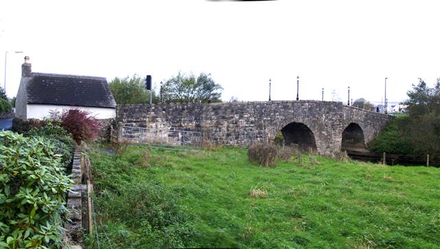
Image: © Kenneth Allen Taken: 11 Nov 2007
Yes! - Campsie Bridge spanning the river Drumragh, along with its toll house, but it was only so known until the erection of the present Campsie Bridge at Lower Market Street in 1838. Now it is called King James Bridge.
Images are licensed for reuse under creativecommons.org/licenses/by-sa/2.0
Image Location


Leaflet Map data © OpenStreetMap
Latitude
54.595976
Longitude
-7.292179