Boundary Marker by the A386, near Higher Beardon Farm
Introduction
The photograph on this page of Boundary Marker by the A386, near Higher Beardon Farm by Alan Rosevear as part of the Geograph project.
The Geograph project started in 2005 with the aim of publishing, organising and preserving representative images for every square kilometre of Great Britain, Ireland and the Isle of Man.

There are currently over 7.5m images from over 14,400 individuals and you can help contribute to the project by visiting https://www.geograph.org.uk
Boundary Marker by the A386, near Higher Beardon Farm
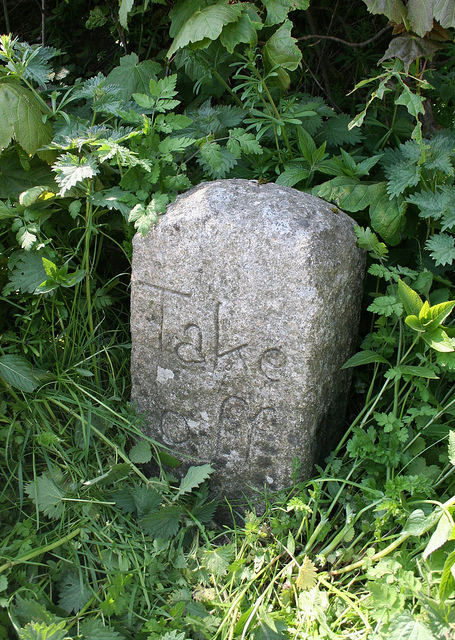
Image: © Alan Rosevear Taken: 20 Apr 2011
Turnpike Horse Marker - 'Take Off' stone, by the A386, in parish of Lydford (West Devon District), Higher Beardon Farm, 20m down towards Lychway path, on grass verge by side of pull-in under hedge. Erected by county Turnpike Trust in the 20th century. Inscription reads:- Take off Devon & Dartmoor HER. HER Number: MDV72012 https://www.heritagegateway.org.uk/Gateway/Results_Single.aspx?uid=MDV72012&resourceID=104 Surveyed Milestone Society National ID: DV_TVOK06hs
Images are licensed for reuse under creativecommons.org/licenses/by-sa/2.0
Image Location
Latitude
50.639252
Longitude
-4.09684