Old Boundary Marker by the River Ness
Introduction
The photograph on this page of Old Boundary Marker by the River Ness by Milestone Society as part of the Geograph project.
The Geograph project started in 2005 with the aim of publishing, organising and preserving representative images for every square kilometre of Great Britain, Ireland and the Isle of Man.

There are currently over 7.5m images from over 14,400 individuals and you can help contribute to the project by visiting https://www.geograph.org.uk
Old Boundary Marker by the River Ness
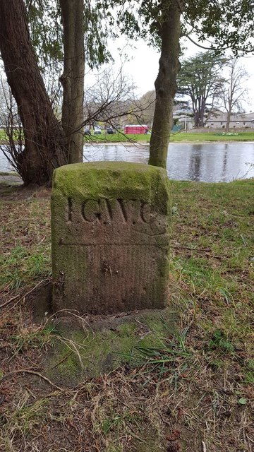
Image: © Milestone Society Taken: 1 May 2017
Estate Boundary Marker - Water Company in parish of Inverness and Bona (Highland Council), North of Ness Islands, opposite Fisherman's Car Park. Inscription reads:- I.G.W.C. The lade (water channel) once supplied Inverness Gas and Water Company's steam-powered pumping station. Surveyed Milestone Society National ID: IV_INV01em
Images are licensed for reuse under creativecommons.org/licenses/by-sa/2.0
Image Location


Leaflet Map data © OpenStreetMap
Latitude
57.467893
Longitude
-4.227853