Old Guide Stone former A30, Penhale, St Enoder parish
Introduction
The photograph on this page of Old Guide Stone former A30, Penhale, St Enoder parish by Milestone Society as part of the Geograph project.
The Geograph project started in 2005 with the aim of publishing, organising and preserving representative images for every square kilometre of Great Britain, Ireland and the Isle of Man.

There are currently over 7.5m images from over 14,400 individuals and you can help contribute to the project by visiting https://www.geograph.org.uk
Old Guide Stone former A30, Penhale, St Enoder parish
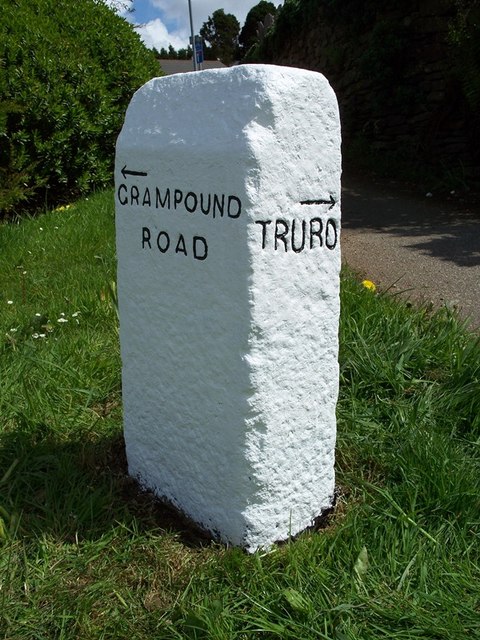
Image: © Milestone Society Taken: Unknown
Guide Stone by the UC road (was A30), in parish of St Enoder (Restormel District), Penhale, South end of Fraddon, by mini roundabout junction with My Lord's Road. Inscription reads:- : {<-arrow} / GRAMPOUND / ROAD : : {arrow->} / TRURO : Grade II listed. List Entry Number: 1311854 https://historicengland.org.uk/listing/the-list/list-entry/1311854 Surveyed Milestone Society National ID: CW_XSTEN
Images are licensed for reuse under creativecommons.org/licenses/by-sa/2.0
Image Location
Latitude
50.381247
Longitude
-4.941025