Old Boundary Marker by Lache Lane, Marlston Cum Lache
Introduction
The photograph on this page of Old Boundary Marker by Lache Lane, Marlston Cum Lache by Milestone Society as part of the Geograph project.
The Geograph project started in 2005 with the aim of publishing, organising and preserving representative images for every square kilometre of Great Britain, Ireland and the Isle of Man.

There are currently over 7.5m images from over 14,400 individuals and you can help contribute to the project by visiting https://www.geograph.org.uk
Old Boundary Marker by Lache Lane, Marlston Cum Lache
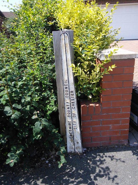
Image: © Milestone Society Taken: Unknown
County Boundary Marker by the UC road, in parish of Marlston Cum Lache (Chester District), Lache Lane, against brick wall on the pavement, Northwest side of road. Opposite Greenacre Road and Boundary Marker: CH_CHECO04cb Image Inscription reads vertically:- : CHESHIRE COUNTY COUNCIL : : CITY OF CHESTER : To be surveyed Milestone Society National ID: CH_CHECO03cb
Images are licensed for reuse under creativecommons.org/licenses/by-sa/2.0
Image Location
Latitude
53.166739
Longitude
-2.916811