Old Boundary Marker by Moscow Road, Kensington
Introduction
The photograph on this page of Old Boundary Marker by Moscow Road, Kensington by Milestone Society as part of the Geograph project.
The Geograph project started in 2005 with the aim of publishing, organising and preserving representative images for every square kilometre of Great Britain, Ireland and the Isle of Man.

There are currently over 7.5m images from over 14,400 individuals and you can help contribute to the project by visiting https://www.geograph.org.uk
Old Boundary Marker by Moscow Road, Kensington
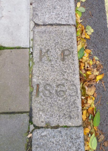
Image: © Milestone Society Taken: Unknown
Parish Boundary Marker by the UC road, in parish of Kensington (Kensington and Chelsea District), Moscow Road W2, in kerb by entrance to No 19E Pembridge Square. Inscription reads:- K P 1869 Surveyed Milestone Society National ID: MX_KENS19pb
Images are licensed for reuse under creativecommons.org/licenses/by-sa/2.0
Image Location


Leaflet Map data © OpenStreetMap
Latitude
51.511765
Longitude
-0.193435