Old Boundary Marker by New Road, Fortuneswell
Introduction
The photograph on this page of Old Boundary Marker by New Road, Fortuneswell by Milestone Society as part of the Geograph project.
The Geograph project started in 2005 with the aim of publishing, organising and preserving representative images for every square kilometre of Great Britain, Ireland and the Isle of Man.

There are currently over 7.5m images from over 14,400 individuals and you can help contribute to the project by visiting https://www.geograph.org.uk
Old Boundary Marker by New Road, Fortuneswell
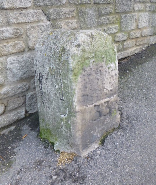
Image: © Milestone Society Taken: Unknown
Estate Boundary Marker - War Department by the A354, in parish of Portland (Weymouth and Portland District), New Road/Fortuneswell, at junction with Verne Hill Road, against wall. Inscription reads:- : ^ / W D : : 33 : Dorset HER. HER Number: MDO31663 https://www.heritagegateway.org.uk/Gateway/Results_Single.aspx?uid=MDO31663&resourceID=1012 Surveyed Milestone Society National ID: DO_WDPOR33em
Images are licensed for reuse under creativecommons.org/licenses/by-sa/2.0
Image Location
Latitude
50.558425
Longitude
-2.439868