Old Boundary Marker by the B4580, Mount Road, Oswestry
Introduction
The photograph on this page of Old Boundary Marker by the B4580, Mount Road, Oswestry by Milestone Society as part of the Geograph project.
The Geograph project started in 2005 with the aim of publishing, organising and preserving representative images for every square kilometre of Great Britain, Ireland and the Isle of Man.

There are currently over 7.5m images from over 14,400 individuals and you can help contribute to the project by visiting https://www.geograph.org.uk
Old Boundary Marker by the B4580, Mount Road, Oswestry
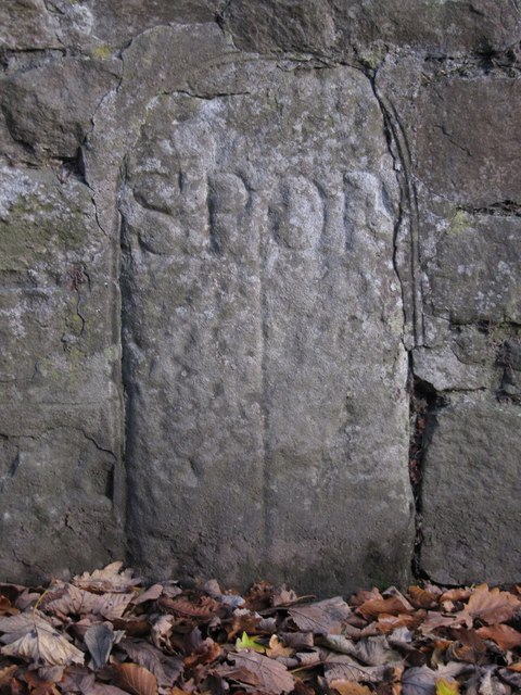
Image: © Milestone Society Taken: Unknown
Parish Boundary Marker by the B4580, in parish of Oswestry Rural (Oswestry District), Lower Mount, built into wall. Inscription reads:- SP|OP (Selattyn Parish|Oswestry Parish) Grade II listed. List Entry Number: 1054227 https://historicengland.org.uk/listing/the-list/list-entry/1054227 Surveyed Milestone Society National ID: SA_OWLS00pb
Images are licensed for reuse under creativecommons.org/licenses/by-sa/2.0
Image Location
Latitude
52.865404
Longitude
-3.068366