Old Direction Sign - Signpost by the A2214, Herne Hill
Introduction
The photograph on this page of Old Direction Sign - Signpost by the A2214, Herne Hill by Milestone Society as part of the Geograph project.
The Geograph project started in 2005 with the aim of publishing, organising and preserving representative images for every square kilometre of Great Britain, Ireland and the Isle of Man.

There are currently over 7.5m images from over 14,400 individuals and you can help contribute to the project by visiting https://www.geograph.org.uk
Old Direction Sign - Signpost by the A2214, Herne Hill
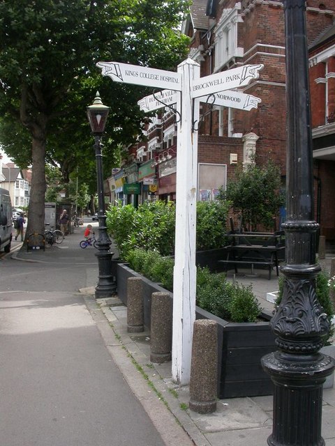
Image: © Milestone Society Taken: Unknown
Pyramid top finial - 4 arms; Dulwich cuffed hand by the A2214, in parish of Camberwell and Dulwich (Southwark District), Herne Hill, Half Moon Lane, at junction of Dulwich Road, Herne Hill, Norwood and Croxted Roads. Signpost has been moved slightly West since the photo was taken and new fencing has been erected. Surveyed Milestone Society National ID: SY_TQ3274A
Images are licensed for reuse under creativecommons.org/licenses/by-sa/2.0
Image Location
Latitude
51.452828
Longitude
-0.100726