Old Milestone by the B3237, Higher Clovelly
Introduction
The photograph on this page of Old Milestone by the B3237, Higher Clovelly by Milestone Society as part of the Geograph project.
The Geograph project started in 2005 with the aim of publishing, organising and preserving representative images for every square kilometre of Great Britain, Ireland and the Isle of Man.

There are currently over 7.5m images from over 14,400 individuals and you can help contribute to the project by visiting https://www.geograph.org.uk
Old Milestone by the B3237, Higher Clovelly
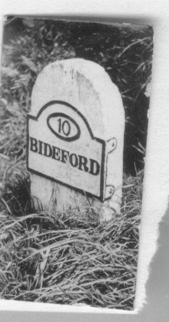
Image: © Milestone Society Taken: Unknown
Bideford iron plate by the UC road, in parish of Clovelly (Torridge District), roadside, by the road. Lost since 1940. Inscription reads:- 10 BIDEFORD Milestone Society National ID: DV_BFHL10a
Images are licensed for reuse under creativecommons.org/licenses/by-sa/2.0
Image Location
Latitude
50.988825
Longitude
-4.406714