Old Boundary Marker by the A420, Deanery Road, Warmley
Introduction
The photograph on this page of Old Boundary Marker by the A420, Deanery Road, Warmley by Milestone Society as part of the Geograph project.
The Geograph project started in 2005 with the aim of publishing, organising and preserving representative images for every square kilometre of Great Britain, Ireland and the Isle of Man.

There are currently over 7.5m images from over 14,400 individuals and you can help contribute to the project by visiting https://www.geograph.org.uk
Old Boundary Marker by the A420, Deanery Road, Warmley
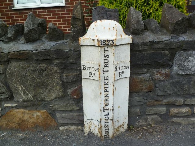
Image: © Milestone Society Taken: Unknown
Parish Boundary Marker - Turnpike by the A420, in parish of Siston (South Gloucestershire District), Deanery Road, Warmley, at junction with Deanery Close, against garden wall. Inscription reads:- : BITTON / Pᴴ. : : 1823 / BRISTOL TURNPIKE TRUST : : SISTON / Pᴴ. : Surveyed Milestone Society National ID: GL_BRCP04pb
Images are licensed for reuse under creativecommons.org/licenses/by-sa/2.0
Image Location
Latitude
51.460124
Longitude
-2.479274