Old Terminus Marker by the A386, Lower Downtown, Lydford
Introduction
The photograph on this page of Old Terminus Marker by the A386, Lower Downtown, Lydford by Alan Rosevear as part of the Geograph project.
The Geograph project started in 2005 with the aim of publishing, organising and preserving representative images for every square kilometre of Great Britain, Ireland and the Isle of Man.

There are currently over 7.5m images from over 14,400 individuals and you can help contribute to the project by visiting https://www.geograph.org.uk
Old Terminus Marker by the A386, Lower Downtown, Lydford
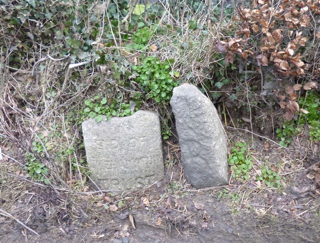
Image: © Alan Rosevear Taken: 1 Mar 2013
Turnpike Terminus Marker by the A386, in parish of Lydford (West Devon District), Lower Downtown, North of Dartmoor Inn, directly opposite the wide entrance to The Paddock, in hedge bank, beside guide stone: DV_XLYDpb Image Surveyed Milestone Society National ID: DV_TVOK08t
Images are licensed for reuse under creativecommons.org/licenses/by-sa/2.0
Image Location
Latitude
50.651858
Longitude
-4.090002