Old Boundary Marker by the B3148, Marston Road, Sherborne
Introduction
The photograph on this page of Old Boundary Marker by the B3148, Marston Road, Sherborne by Mike Faherty as part of the Geograph project.
The Geograph project started in 2005 with the aim of publishing, organising and preserving representative images for every square kilometre of Great Britain, Ireland and the Isle of Man.

There are currently over 7.5m images from over 14,400 individuals and you can help contribute to the project by visiting https://www.geograph.org.uk
Old Boundary Marker by the B3148, Marston Road, Sherborne
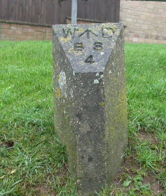
Image: © Mike Faherty Taken: 19 Jan 2008
Estate Boundary Marker - War Department by the B3148, in parish of Sherborne (North Dorset District), Marston Road, junction with Sheeplands Lane, on bank. Inscription reads:- W^D BS 4 Surveyed Milestone Society National ID: DO_WDSHE04em
Images are licensed for reuse under creativecommons.org/licenses/by-sa/2.0
Image Location
Latitude
50.953891
Longitude
-2.527874