Old Boundary Marker by the A58, Rochdale Road, Halifax
Introduction
The photograph on this page of Old Boundary Marker by the A58, Rochdale Road, Halifax by Milestone Society as part of the Geograph project.
The Geograph project started in 2005 with the aim of publishing, organising and preserving representative images for every square kilometre of Great Britain, Ireland and the Isle of Man.

There are currently over 7.5m images from over 14,400 individuals and you can help contribute to the project by visiting https://www.geograph.org.uk
Old Boundary Marker by the A58, Rochdale Road, Halifax
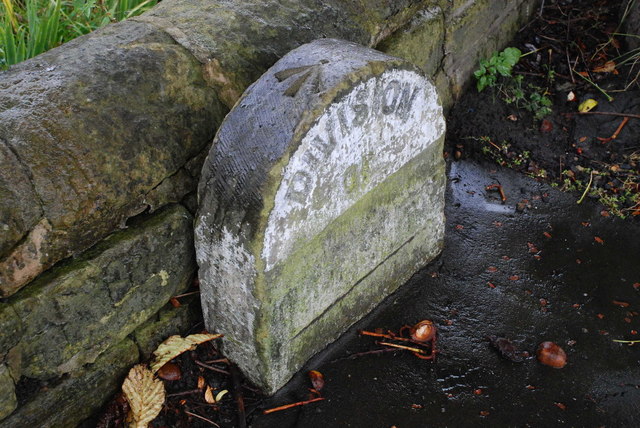
Image: © Milestone Society Taken: Unknown
Parish Boundary Marker by the A58, in parish of Halifax (Calderdale District), Rochdale Road, Pye Nest, opposite Willow Dene Avenue, against low stone wall and next to large tree. Inscription reads:- DIVISION OF (??) Carved benchmark on top. To be surveyed Milestone Society National ID: YW_SOWB03pb
Images are licensed for reuse under creativecommons.org/licenses/by-sa/2.0
Image Location
Latitude
53.715622
Longitude
-1.899125