Alexandra Terrace
Introduction
The photograph on this page of Alexandra Terrace by Ian Capper as part of the Geograph project.
The Geograph project started in 2005 with the aim of publishing, organising and preserving representative images for every square kilometre of Great Britain, Ireland and the Isle of Man.

There are currently over 7.5m images from over 14,400 individuals and you can help contribute to the project by visiting https://www.geograph.org.uk
Alexandra Terrace
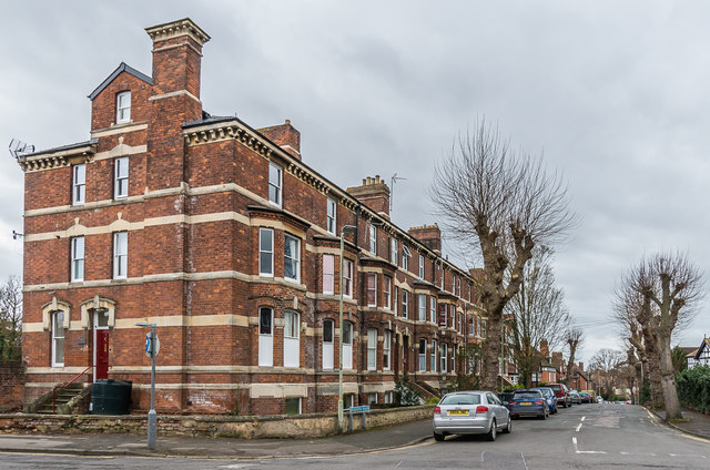
Image: © Ian Capper Taken: 16 Mar 2019
Terrace of houses in Alexandra Road by its junction with Denmark Road, dating from 1870 and designed by A W Maberly, who in partnership with James Medland also designed many of Gloucester's public buildings.
Images are licensed for reuse under creativecommons.org/licenses/by-sa/2.0
Image Location
Latitude
51.870399
Longitude
-2.231266