Chopwell Colliery Wheel
Introduction
The photograph on this page of Chopwell Colliery Wheel by Oliver Dixon as part of the Geograph project.
The Geograph project started in 2005 with the aim of publishing, organising and preserving representative images for every square kilometre of Great Britain, Ireland and the Isle of Man.

There are currently over 7.5m images from over 14,400 individuals and you can help contribute to the project by visiting https://www.geograph.org.uk
Chopwell Colliery Wheel
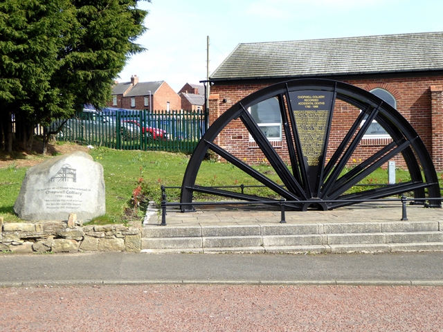
Image: © Oliver Dixon Taken: 21 Mar 2019
Like many of the former coalmining villages in the North-East, a winding wheel commemorates the local colliery. The stone to the left dates the colliery from 1896, but on the wheel itself is a plaque listing about 70 known fatalities from 1782 (presumably including those from an older colliery on the same site). Mining ceased in 1966.
Images are licensed for reuse under creativecommons.org/licenses/by-sa/2.0
Image Location
Latitude
54.918722
Longitude
-1.817597