
View from St James's Lane Viaduct
Introduction
The photograph on this page of View from St James's Lane Viaduct by Marathon as part of the Geograph project.
The Geograph project started in 2005 with the aim of publishing, organising and preserving representative images for every square kilometre of Great Britain, Ireland and the Isle of Man.

There are currently over 7.5m images from over 14,400 individuals and you can help contribute to the project by visiting https://www.geograph.org.uk
View from St James's Lane Viaduct
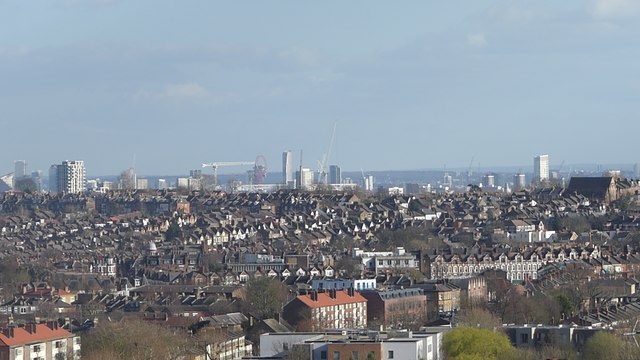
Image: © Marathon Taken: 11 Mar 2019
This is the view across London from St James's Lane Viaduct on the Parkland Walk. Storm Freya had cleared the air. The ArcelorMittal Orbit Tower and the buildings around Stratford are slightly left of centre. The Parkland Walk is the former track of the branch railway line which ran from Finsbury Park to Alexandra Palace and closed to passengers in 1954 and finally in 1971. The Parkland Walk officially opened in 1984. The first part of the Parkland Walk goes from Finsbury Park to Archway Road. The old track of the railway then passes through Highgate Wood before it is rejoined at Muswell Hill Road and heads to Alexandra Palace across St James's Lane Viaduct.
Images are licensed for reuse under creativecommons.org/licenses/by-sa/2.0
Image Location

Latitude
51.586551
Longitude
-0.140264