Bolesbridge Water
Introduction
The photograph on this page of Bolesbridge Water by Derek Harper as part of the Geograph project.
The Geograph project started in 2005 with the aim of publishing, organising and preserving representative images for every square kilometre of Great Britain, Ireland and the Isle of Man.

There are currently over 7.5m images from over 14,400 individuals and you can help contribute to the project by visiting https://www.geograph.org.uk
Bolesbridge Water
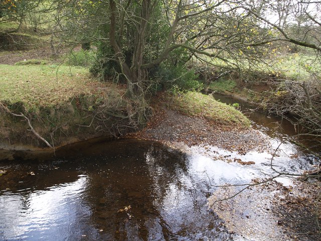
Image: © Derek Harper Taken: 9 Nov 2007
The stream twists and turns its way in tight meanders across this level stretch of valley. Here it has formed a couple of miniature slip-off slopes while undermining the adjacent banks.
Images are licensed for reuse under creativecommons.org/licenses/by-sa/2.0
Image Location
Latitude
50.684541
Longitude
-4.422576