Melrose Town Centre from Quarry Hill
Introduction
The photograph on this page of Melrose Town Centre from Quarry Hill by Walter Baxter as part of the Geograph project.
The Geograph project started in 2005 with the aim of publishing, organising and preserving representative images for every square kilometre of Great Britain, Ireland and the Isle of Man.

There are currently over 7.5m images from over 14,400 individuals and you can help contribute to the project by visiting https://www.geograph.org.uk
Melrose Town Centre from Quarry Hill
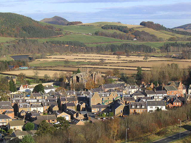
Image: © Walter Baxter Taken: 9 Nov 2007
A view of the town from Quarry Hill with Melrose Abbey prominent in the centre. The medieval and early modern town of Melrose grew up at the gates of the abbey. The earlier buildings at the abbey between 1136 and 1385 are constructed largely of volcanic agglomerate, mainly obtained from the old quarry on the north face of Quarry Hill. Rich farmland by the River Tweed is beyond at Gattonsidehaugh. The distinctive hill on the skyline to the left is the Black Hill near Earlston. A small section of the Melrose Bypass road (A6091) on the route of the former Waverley Railway Line is on the bottom right corner.
Images are licensed for reuse under creativecommons.org/licenses/by-sa/2.0
Image Location
Latitude
55.598222
Longitude
-2.720442