Unitarian Chapel. The Twitten
Introduction
The photograph on this page of Unitarian Chapel. The Twitten by Simon Carey as part of the Geograph project.
The Geograph project started in 2005 with the aim of publishing, organising and preserving representative images for every square kilometre of Great Britain, Ireland and the Isle of Man.

There are currently over 7.5m images from over 14,400 individuals and you can help contribute to the project by visiting https://www.geograph.org.uk
Unitarian Chapel. The Twitten
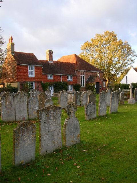
Image: © Simon Carey Taken: 10 Nov 2007
Known as the Old Meeting House though the whole is a conglomeration of different buildings. The middle part is the oldest being the original cottage which the right hand meeting hall was appended to in 1740 and the left hand side added in 1806 to house the minister and his family.
Images are licensed for reuse under creativecommons.org/licenses/by-sa/2.0
Image Location
Latitude
50.921647
Longitude
-0.113972