Central Methodist Church, Horsforth
Introduction
The photograph on this page of Central Methodist Church, Horsforth by Stephen Craven as part of the Geograph project.
The Geograph project started in 2005 with the aim of publishing, organising and preserving representative images for every square kilometre of Great Britain, Ireland and the Isle of Man.

There are currently over 7.5m images from over 14,400 individuals and you can help contribute to the project by visiting https://www.geograph.org.uk
Central Methodist Church, Horsforth
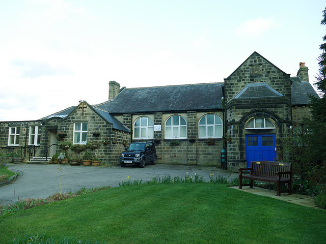
Image: © Stephen Craven Taken: 12 Mar 2019
A datestone Image gives the original build date of 1846 - and indeed it is shown as a chapel on the 1851 map - and "rebuilt 1911". The round-headed windows certainly look more in keeping with the later date.
Images are licensed for reuse under creativecommons.org/licenses/by-sa/2.0
Image Location
Latitude
53.839592
Longitude
-1.637518