
The Lawn [2]
Introduction
The photograph on this page of The Lawn [2] by Michael Dibb as part of the Geograph project.
The Geograph project started in 2005 with the aim of publishing, organising and preserving representative images for every square kilometre of Great Britain, Ireland and the Isle of Man.

There are currently over 7.5m images from over 14,400 individuals and you can help contribute to the project by visiting https://www.geograph.org.uk
The Lawn [2]
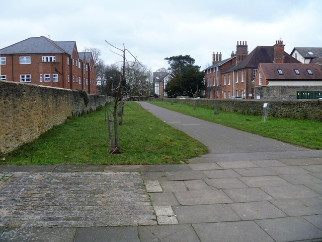
Image: © Michael Dibb Taken: 16 Feb 2019
The avenue leading from High Street to The Lawn, an urban greenspace open to the public, owned by Swindon Council. The trees are replacements for trees damaged in the storms of 1989. The Lawn was part of the Goddard family estate and they lived in a circa 1770 manor houses known as Swindon House and later known as The Lawn. The last of the family left Swindon in 1931 and the manor house was empty until used by the military in World War II. The manor house and 47 acres of land were purchased by Swindon Corporation in 1947. Damaged and derelict the house was demolished in 1952. The grounds were opened as parkland and remain so.
Images are licensed for reuse under creativecommons.org/licenses/by-sa/2.0
Image Location

Latitude
51.552238
Longitude
-1.772795