Broadland District Council Emergency Centre - the kitchen
Introduction
The photograph on this page of Broadland District Council Emergency Centre - the kitchen by Evelyn Simak as part of the Geograph project.
The Geograph project started in 2005 with the aim of publishing, organising and preserving representative images for every square kilometre of Great Britain, Ireland and the Isle of Man.

There are currently over 7.5m images from over 14,400 individuals and you can help contribute to the project by visiting https://www.geograph.org.uk
Broadland District Council Emergency Centre - the kitchen
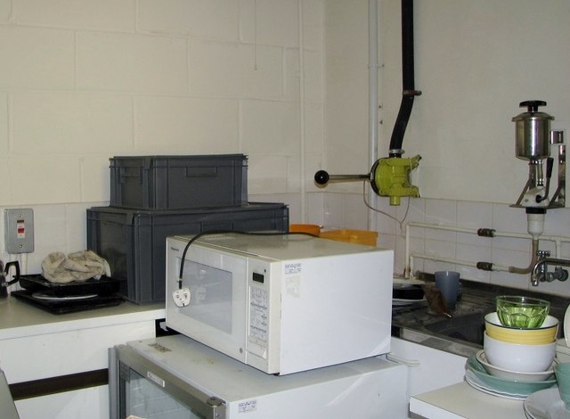
Image: © Evelyn Simak Taken: 14 Mar 2019
The kitchen is still in place and the appliances are fully functional. The object on the wall in the background is a pump supplying the kitchen with filtered and purified water from one of the three water tanks > https://www.geograph.org.uk/photo/6087462 also situated in this bunker.
Images are licensed for reuse under creativecommons.org/licenses/by-sa/2.0
Image Location
Latitude
52.627487
Longitude
1.326946