Broadland District Council Emergency Centre - entrance
Introduction
The photograph on this page of Broadland District Council Emergency Centre - entrance by Evelyn Simak as part of the Geograph project.
The Geograph project started in 2005 with the aim of publishing, organising and preserving representative images for every square kilometre of Great Britain, Ireland and the Isle of Man.

There are currently over 7.5m images from over 14,400 individuals and you can help contribute to the project by visiting https://www.geograph.org.uk
Broadland District Council Emergency Centre - entrance
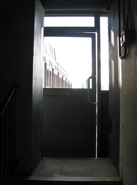
Image: © Evelyn Simak Taken: 14 Mar 2019
View out of the entrance/exit which is protected by a heavy steel blast door. This photo also illustrates very well the thickness (3ft) of the exterior wall. (The door with the glass window is a recent addition, installed to protect the original entrance.) Part of the council offices building can be seen in the background at left. For a view of the stairwell leading down to the bunker's lower level see > https://www.geograph.org.uk/photo/6087645.
Images are licensed for reuse under creativecommons.org/licenses/by-sa/2.0
Image Location
Latitude
52.627487
Longitude
1.326946