Gillingham houses [26]
Introduction
The photograph on this page of Gillingham houses [26] by Michael Dibb as part of the Geograph project.
The Geograph project started in 2005 with the aim of publishing, organising and preserving representative images for every square kilometre of Great Britain, Ireland and the Isle of Man.

There are currently over 7.5m images from over 14,400 individuals and you can help contribute to the project by visiting https://www.geograph.org.uk
Gillingham houses [26]
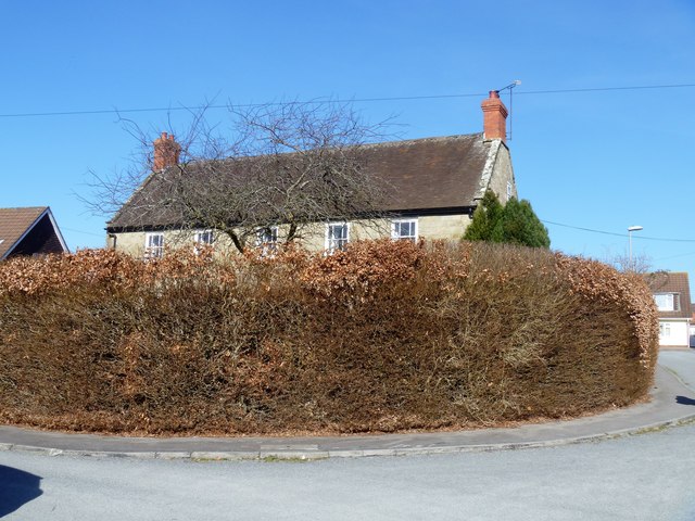
Image: © Michael Dibb Taken: 14 Feb 2019
Lodborne Farmhouse within its enclosing hedge, is late 18th century and is listed, grade II, with details at: https://historicengland.org.uk/listing/the-list/list-entry/1110298 The house is located in the middle of an estate of very ordinary bungalows, presumably built on the farmland. The property is shown as Lodborne Resource Centre under abortion clinics, and a planning application was approved in 2016 to change the building from multiple occupation to one house offering bed and breakfast accommodation.
Images are licensed for reuse under creativecommons.org/licenses/by-sa/2.0
Image Location
Latitude
51.042387
Longitude
-2.276239