Meath Green Lane, Horley
Introduction
The photograph on this page of Meath Green Lane, Horley by Richard Rogerson as part of the Geograph project.
The Geograph project started in 2005 with the aim of publishing, organising and preserving representative images for every square kilometre of Great Britain, Ireland and the Isle of Man.

There are currently over 7.5m images from over 14,400 individuals and you can help contribute to the project by visiting https://www.geograph.org.uk
Meath Green Lane, Horley
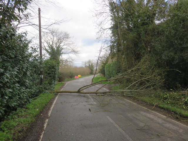
Image: © Richard Rogerson Taken: 10 Mar 2019
The road hase been closed since September 2018 (due to open May 2019) while Sutton and East Surrey (SES) Water has been increasing the size of the existing water pipe. The project involves laying approximately 2,570m of a new 250mm main. The road has been closed except for access but last Sunday there was no access due to high winds bringing down a tree.
Images are licensed for reuse under creativecommons.org/licenses/by-sa/2.0
Image Location
Latitude
51.185582
Longitude
-0.181205