Old Boundary Marker on Thunder Bridge, Birks Lane, Kirkburton
Introduction
The photograph on this page of Old Boundary Marker on Thunder Bridge, Birks Lane, Kirkburton by Milestone Society as part of the Geograph project.
The Geograph project started in 2005 with the aim of publishing, organising and preserving representative images for every square kilometre of Great Britain, Ireland and the Isle of Man.

There are currently over 7.5m images from over 14,400 individuals and you can help contribute to the project by visiting https://www.geograph.org.uk
Old Boundary Marker on Thunder Bridge, Birks Lane, Kirkburton
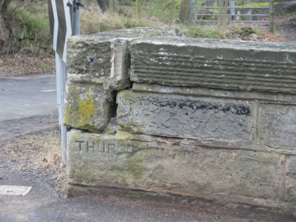
Image: © Milestone Society Taken: Unknown
Parish Boundary Marker by the UC road, in parish of Kirkburton (Kirklees District), Thunder Bridge over Shepley Dike brook, names at each end of parapet. Damaged inscription reads:- THURS(TONLAND) ('SHELLEY' is on the Northeast end of the bridge) Thunder Bridge is Grade II listed. List Entry Number: 1300331 https://historicengland.org.uk/listing/the-list/list-entry/1300331 Surveyed Milestone Society National ID: YW_THUSHE01pb
Images are licensed for reuse under creativecommons.org/licenses/by-sa/2.0
Image Location
Latitude
53.598898
Longitude
-1.717308