Old Guide Stone by Dauby Lane, Elvington
Introduction
The photograph on this page of Old Guide Stone by Dauby Lane, Elvington by Milestone Society as part of the Geograph project.
The Geograph project started in 2005 with the aim of publishing, organising and preserving representative images for every square kilometre of Great Britain, Ireland and the Isle of Man.

There are currently over 7.5m images from over 14,400 individuals and you can help contribute to the project by visiting https://www.geograph.org.uk
Old Guide Stone by Dauby Lane, Elvington
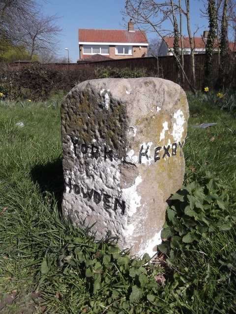
Image: © Milestone Society Taken: Unknown
Guide stone by Dauby Lane to Kexby, in parish of Elvington (York District), North end of village, junction with the B1228. Inscription reads:- : KEXBY : : YORK / HOWDEN : : KEXBY : Carved benchmark and rivet on top. City of York HER. HER Number: MYO4273 https://www.heritagegateway.org.uk/Gateway/Results_Single.aspx?uid=MYO4273&resourceID=1003 Surveyed Milestone Society National ID: YN_XELV
Images are licensed for reuse under creativecommons.org/licenses/by-sa/2.0
Image Location
Latitude
53.923626
Longitude
-0.940063