Tingewick Tollhouse, Main Street, Tingewick
Introduction
The photograph on this page of Tingewick Tollhouse, Main Street, Tingewick by Alan Rosevear as part of the Geograph project.
The Geograph project started in 2005 with the aim of publishing, organising and preserving representative images for every square kilometre of Great Britain, Ireland and the Isle of Man.

There are currently over 7.5m images from over 14,400 individuals and you can help contribute to the project by visiting https://www.geograph.org.uk
Tingewick Tollhouse, Main Street, Tingewick
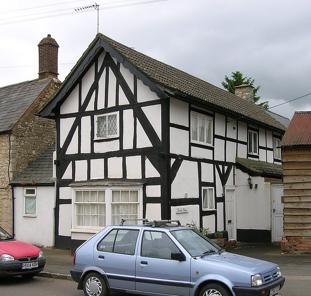
Image: © Alan Rosevear Taken: Unknown
Tollhouse in the parish of Tingewick (Aylesbury Vale District), Church View, Main Street, MK18. Grade II listed. List Entry Number: 1212376 https://historicengland.org.uk/listing/the-list/list-entry/1212376 Surveyed Milestone Society National ID: BU.TIN
Images are licensed for reuse under creativecommons.org/licenses/by-sa/2.0
Image Location
Latitude
51.990447
Longitude
-1.043067