Old Boundary Marker by the A4, The Paragon, Bath
Introduction
The photograph on this page of Old Boundary Marker by the A4, The Paragon, Bath by Milestone Society as part of the Geograph project.
The Geograph project started in 2005 with the aim of publishing, organising and preserving representative images for every square kilometre of Great Britain, Ireland and the Isle of Man.

There are currently over 7.5m images from over 14,400 individuals and you can help contribute to the project by visiting https://www.geograph.org.uk
Old Boundary Marker by the A4, The Paragon, Bath
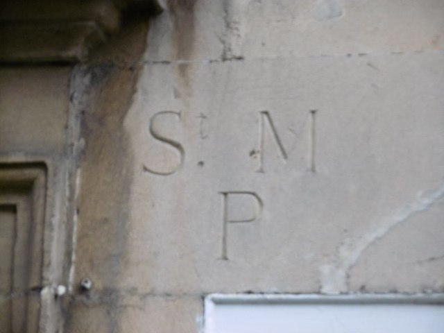
Image: © Milestone Society Taken: Unknown
Parish Boundary Marker by the A4, in parish of Bath (Bath and North East Somerset District), The Paragon, below door lintel of No 27 Axford's buildings. Below Boundary Marker: SO_BHWASM01pb Image Axford's Buildings 22-37 are Grade II listed: List Entry Number: 1394242 https://historicengland.org.uk/listing/the-list/list-entry/1394242 Surveyed Milestone Society National ID: SO_BHSM01pb
Images are licensed for reuse under creativecommons.org/licenses/by-sa/2.0
Image Location
Latitude
51.387612
Longitude
-2.359855