Old Direction Sign - Signpost near Ruthern Bridge, Ruthernbridge
Introduction
The photograph on this page of Old Direction Sign - Signpost near Ruthern Bridge, Ruthernbridge by Milestone Society as part of the Geograph project.
The Geograph project started in 2005 with the aim of publishing, organising and preserving representative images for every square kilometre of Great Britain, Ireland and the Isle of Man.

There are currently over 7.5m images from over 14,400 individuals and you can help contribute to the project by visiting https://www.geograph.org.uk
Old Direction Sign - Signpost near Ruthern Bridge, Ruthernbridge
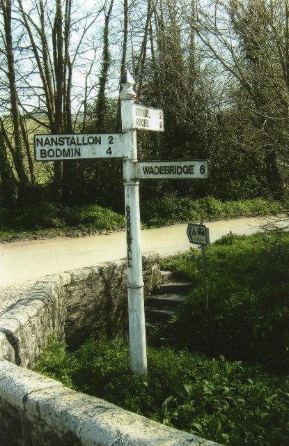
Image: © Milestone Society Taken: Unknown
Pyramid spear finial - 3 arms; Cornwall CC iron spear by the UC road, in parish of Withiel (North Cornwall District), T-junction on East side of Ruthern Bridge, on verge of T-junction behind stone wall. Surveyed Milestone Society National ID: CW_SX0166B
Images are licensed for reuse under creativecommons.org/licenses/by-sa/2.0
Image Location


Leaflet Map data © OpenStreetMap
Latitude
50.467467
Longitude
-4.801128