Old Boundary Marker by Oxleas Wood, Greenwich parish
Introduction
The photograph on this page of Old Boundary Marker by Oxleas Wood, Greenwich parish by Milestone Society as part of the Geograph project.
The Geograph project started in 2005 with the aim of publishing, organising and preserving representative images for every square kilometre of Great Britain, Ireland and the Isle of Man.

There are currently over 7.5m images from over 14,400 individuals and you can help contribute to the project by visiting https://www.geograph.org.uk
Old Boundary Marker by Oxleas Wood, Greenwich parish
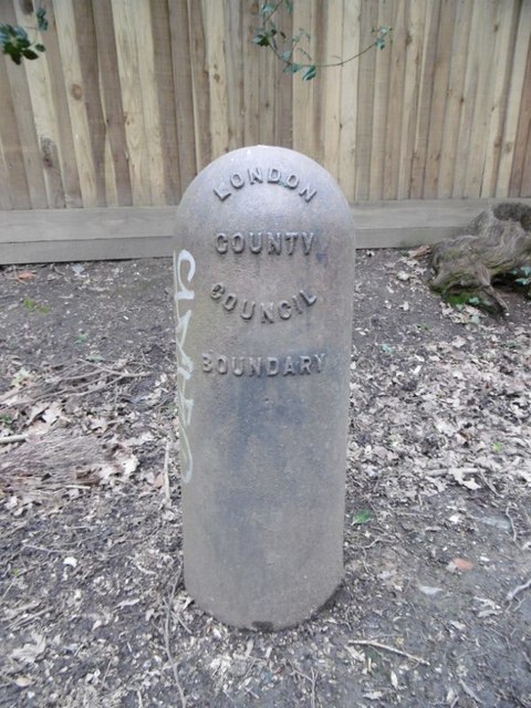
Image: © Milestone Society Taken: Unknown
Estate Boundary Marker in parish of Greenwich (Greenwich District), Oxleas Wood, North of pavement at South end. Inscription reads:- LONDON COUNTY COUNCIL BOUNDARY Surveyed Milestone Society National ID: KE_LCC02em
Images are licensed for reuse under creativecommons.org/licenses/by-sa/2.0
Image Location
Latitude
51.462677
Longitude
0.082373