Tollhouse by School Lane. Mepal
Introduction
The photograph on this page of Tollhouse by School Lane. Mepal by Alan Rosevear as part of the Geograph project.
The Geograph project started in 2005 with the aim of publishing, organising and preserving representative images for every square kilometre of Great Britain, Ireland and the Isle of Man.

There are currently over 7.5m images from over 14,400 individuals and you can help contribute to the project by visiting https://www.geograph.org.uk
Tollhouse by School Lane. Mepal
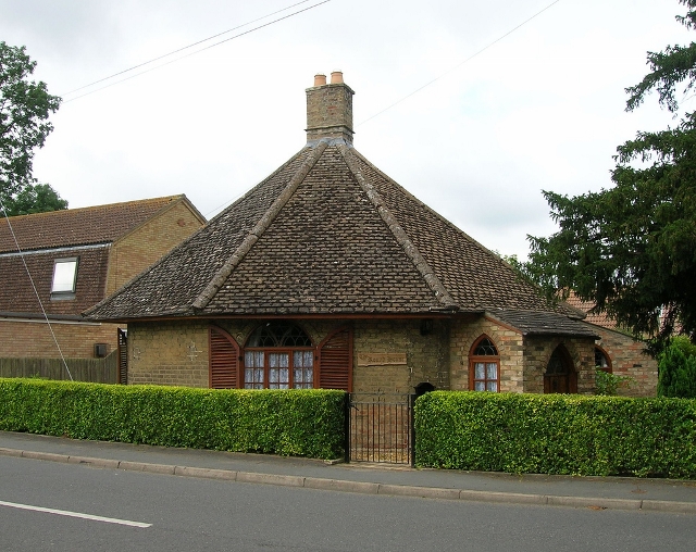
Image: © Alan Rosevear Taken: Unknown
In the parish of Mepal (East Cambridgeshire District), The Round House, School Lane, opposite junction with High Street. Grade II listed. List Entry Number: 1126975 https://historicengland.org.uk/listing/the-list/list-entry/1126975 Surveyed Milestone Society National ID: CA.MEP
Images are licensed for reuse under creativecommons.org/licenses/by-sa/2.0
Image Location
Latitude
52.406261
Longitude
0.117591