Old Milestone south of Norton Bavant, Heytesbury parish
Introduction
The photograph on this page of Old Milestone south of Norton Bavant, Heytesbury parish by M Faherty as part of the Geograph project.
The Geograph project started in 2005 with the aim of publishing, organising and preserving representative images for every square kilometre of Great Britain, Ireland and the Isle of Man.

There are currently over 7.5m images from over 14,400 individuals and you can help contribute to the project by visiting https://www.geograph.org.uk
Old Milestone south of Norton Bavant, Heytesbury parish
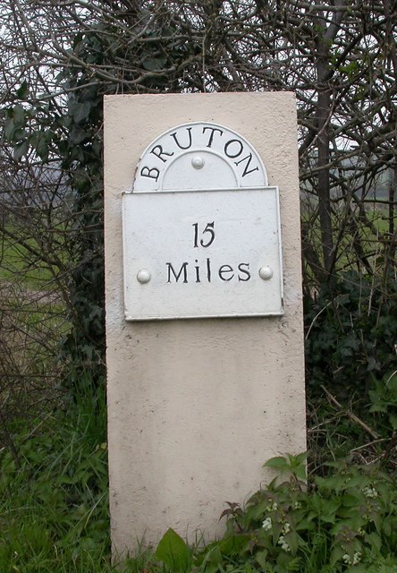
Image: © M Faherty Taken: 1 Apr 2007
Metal plate attached to concrete post by the UC road, in parish of HEYTESBURY (WEST WILTSHIRE District), 100m East of junction with road to Norton Bavant, 50m East of Langleys Gore, in hedgerow, on North side of road. Bruton Sun iron plate, erected by the Bruton turnpike trust in the 18th century. Inscription reads:- BRUTON 15 Miles Milestone Society National ID: WI_BNMB15.
Images are licensed for reuse under creativecommons.org/licenses/by-sa/2.0
Image Location
Latitude
51.185124
Longitude
-2.127017