Old Milestone by the A443, Hallow Road, Worcester parish
Introduction
The photograph on this page of Old Milestone by the A443, Hallow Road, Worcester parish by J Higgins as part of the Geograph project.
The Geograph project started in 2005 with the aim of publishing, organising and preserving representative images for every square kilometre of Great Britain, Ireland and the Isle of Man.

There are currently over 7.5m images from over 14,400 individuals and you can help contribute to the project by visiting https://www.geograph.org.uk
Old Milestone by the A443, Hallow Road, Worcester parish
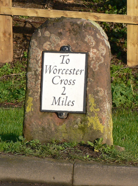
Image: © J Higgins Taken: 20 Dec 2014
Metal plate attached to stone post by the A443, in parish of WORCESTER (WORCESTER District), City boundary, Hallow Road, South corner of Little Eastbury, on the verge, close to road, on East side of road. Worcester Cross iron plate, erected by the Worcester turnpike trust in the 19th century. Inscription reads:- To Worcester Cross 2 Miles Carved bench mark and rivet on top. Milestone Society National ID: WO_WOGW02.
Images are licensed for reuse under creativecommons.org/licenses/by-sa/2.0
Image Location
Latitude
52.210661
Longitude
-2.248295