Former St Gluvias Tollhouse, Lower Treluswell
Introduction
The photograph on this page of Former St Gluvias Tollhouse, Lower Treluswell by Alan Rosevear as part of the Geograph project.
The Geograph project started in 2005 with the aim of publishing, organising and preserving representative images for every square kilometre of Great Britain, Ireland and the Isle of Man.

There are currently over 7.5m images from over 14,400 individuals and you can help contribute to the project by visiting https://www.geograph.org.uk
Former St Gluvias Tollhouse, Lower Treluswell
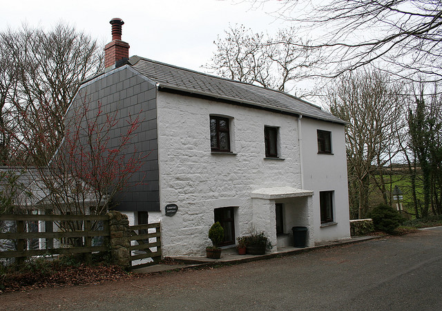
Image: © Alan Rosevear Taken: 26 Feb 2009
Tollhouse by the unclassified road (was A39), in the parish of St. Gluvias (Kerrier District), Turnpike Cottage, The Barns, Lower Treluswell, TR10 9AT. Cornwall & Scilly HER. HER Number: 176751 https://www.heritagegateway.org.uk/Gateway/Results_Single.aspx?uid=MCO52560&resourceID=1020 Surveyed Milestone Society National ID: CW.SGL
Images are licensed for reuse under creativecommons.org/licenses/by-sa/2.0
Image Location
Latitude
50.189153
Longitude
-5.124997