Old milemarker near Lingards Wood, west of Slaithwaite
Introduction
The photograph on this page of Old milemarker near Lingards Wood, west of Slaithwaite by Milestone Society as part of the Geograph project.
The Geograph project started in 2005 with the aim of publishing, organising and preserving representative images for every square kilometre of Great Britain, Ireland and the Isle of Man.

There are currently over 7.5m images from over 14,400 individuals and you can help contribute to the project by visiting https://www.geograph.org.uk
Old milemarker near Lingards Wood, west of Slaithwaite
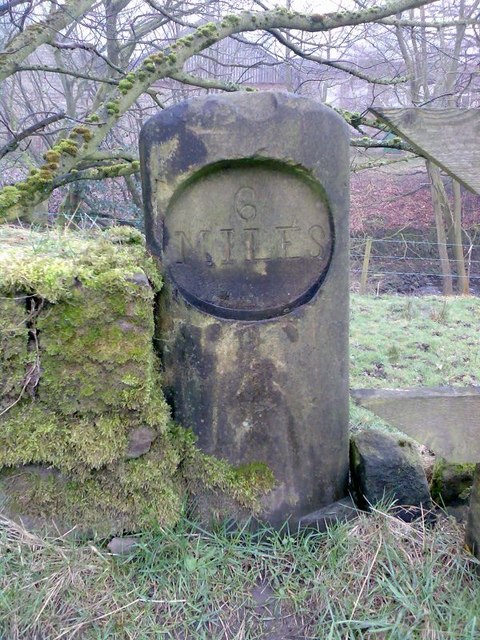
Image: © Milestone Society Taken: Unknown
Milemarker by the Huddersfield Narrow Canal, in parish of Huddersfield (Kirklees District), Lingards Wood, attached to low stone wall. Inscription reads:- 6 MILES Grade II listed. List Entry Number: 1243467 https://historicengland.org.uk/listing/the-list/list-entry/1243467 Surveyed Milestone Society National ID: HUN-06
Images are licensed for reuse under creativecommons.org/licenses/by-sa/2.0
Image Location
Latitude
53.614125
Longitude
-1.906547