Old circular AA Sign in Stokeham
Introduction
The photograph on this page of Old circular AA Sign in Stokeham by Milestone Society as part of the Geograph project.
The Geograph project started in 2005 with the aim of publishing, organising and preserving representative images for every square kilometre of Great Britain, Ireland and the Isle of Man.

There are currently over 7.5m images from over 14,400 individuals and you can help contribute to the project by visiting https://www.geograph.org.uk
Old circular AA Sign in Stokeham
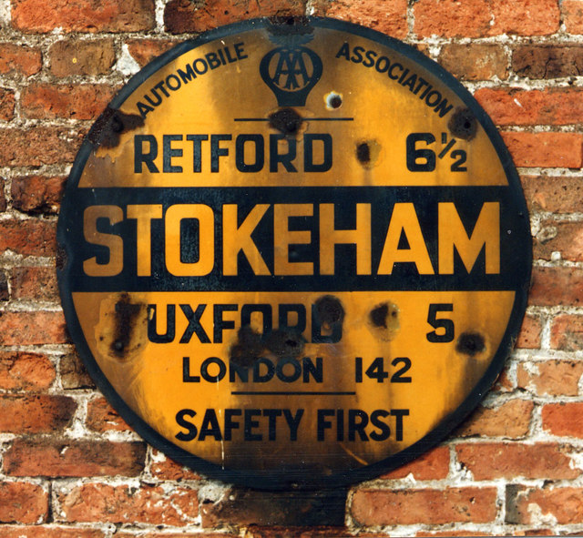
Image: © Milestone Society Taken: Unknown
Old AA Sign in Stokeham, 6 miles southeast of Retford. Stokeham parish. This is the circular, village name on black band, no Motor Union symbol or name type, dating from 1923, and showing distances Retford 6½ Tuxford 5 London 142. Now missing. There were five series of AA signs, mostly dating from 1923 and made by Francis & Co / Franco in Deptford, London. The village name and distance to London were usually displayed. Milestone Society National ID: NT-STOKE
Images are licensed for reuse under creativecommons.org/licenses/by-sa/2.0
Image Location
Latitude
53.282402
Longitude
-0.82706