Parish Boundary Marker by the A376, Exmouth Road, Winslade
Introduction
The photograph on this page of Parish Boundary Marker by the A376, Exmouth Road, Winslade by Alan Rosevear as part of the Geograph project.
The Geograph project started in 2005 with the aim of publishing, organising and preserving representative images for every square kilometre of Great Britain, Ireland and the Isle of Man.

There are currently over 7.5m images from over 14,400 individuals and you can help contribute to the project by visiting https://www.geograph.org.uk
Parish Boundary Marker by the A376, Exmouth Road, Winslade
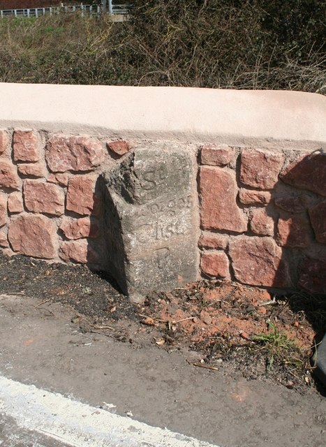
Image: © Alan Rosevear Taken: 27 Mar 2012
Parish Boundary Marker by the A376, in parish of Clyst St Mary (Exeter District), Winslade, bridge over stream, on North-bound carriageway, South of Winslade Park, in the stone wall of on Southeast edge of bridge parapet (newly set in 2012). Inscription reads: : (St) / Mary / Clist / P : : St / Georges / Clist / P : Surveyed Milestone Society National ID: DV_EXEM04pb
Images are licensed for reuse under creativecommons.org/licenses/by-sa/2.0
Image Location
Latitude
50.703425
Longitude
-3.453134