Old Milestone by the A671, Bank Terrace, Market Street, Whitworth
Introduction
The photograph on this page of Old Milestone by the A671, Bank Terrace, Market Street, Whitworth by J Higgins as part of the Geograph project.
The Geograph project started in 2005 with the aim of publishing, organising and preserving representative images for every square kilometre of Great Britain, Ireland and the Isle of Man.

There are currently over 7.5m images from over 14,400 individuals and you can help contribute to the project by visiting https://www.geograph.org.uk
Old Milestone by the A671, Bank Terrace, Market Street, Whitworth
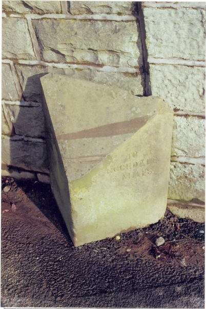
Image: © J Higgins Taken: 1 Nov 2008
Carved stone post by the A671, in parish of WHITWORTH (ROSSENDALE District), Whitworth, Bank Terrace (in road!), on East side of road. Lancs CC stone triangle, erected by the County Council in the 19th/20th century. Inscription reads:- : TO / BACUP / 2 MILES : : TO / ROCHDALE / 5 MILES : Milestone Society National ID: LA_BCRD04.
Images are licensed for reuse under creativecommons.org/licenses/by-sa/2.0
Image Location
Latitude
53.656553
Longitude
-2.17713