Old Milepost by the A30, Firsdown parish
Introduction
The photograph on this page of Old Milepost by the A30, Firsdown parish by Milestone Society as part of the Geograph project.
The Geograph project started in 2005 with the aim of publishing, organising and preserving representative images for every square kilometre of Great Britain, Ireland and the Isle of Man.

There are currently over 7.5m images from over 14,400 individuals and you can help contribute to the project by visiting https://www.geograph.org.uk
Old Milepost by the A30, Firsdown parish
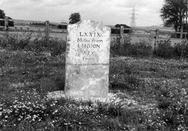
Image: © Milestone Society Taken: Unknown
Sarum triangle by the A30, in parish of Firsdown (Salisbury District), roadside, by the South side of road. Lost since 1980 Inscription reads:- LXXIX Miles from LONDON XIX from Andover Grade II listed. List Entry Number: 1183891 https://historicengland.org.uk/listing/the-list/list-entry/1183891 Milestone Society National ID: WI_SAAV03
Images are licensed for reuse under creativecommons.org/licenses/by-sa/2.0
Image Location


Leaflet Map data © OpenStreetMap
Latitude
51.096401
Longitude
-1.742117