Old Milestone by the A3121, Lower Bowcombe, Ugborough parish
Introduction
The photograph on this page of Old Milestone by the A3121, Lower Bowcombe, Ugborough parish by A Rosevear as part of the Geograph project.
The Geograph project started in 2005 with the aim of publishing, organising and preserving representative images for every square kilometre of Great Britain, Ireland and the Isle of Man.

There are currently over 7.5m images from over 14,400 individuals and you can help contribute to the project by visiting https://www.geograph.org.uk
Old Milestone by the A3121, Lower Bowcombe, Ugborough parish
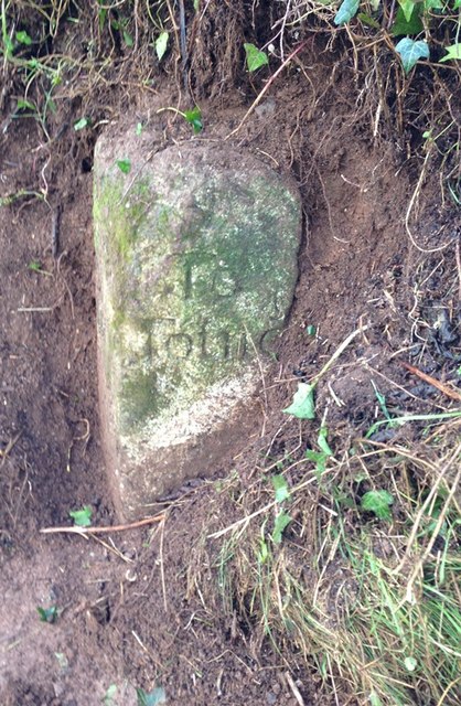
Image: © A Rosevear Taken: 14 Feb 2013
Carved stone post by the A3121, in parish of UGBOROUGH (SOUTH HAMS District), Lower Bowcombe, West of farm lane, on bend, in the hedge bank, on South side of road. Modbury Totnes marker, erected by the Modbury turnpike trust in the 19th century. Inscription reads:- : 13 / To / Plymo : : 9 / To / Totnes : Carved benchmark on RH top edge with pivot. Devon & Dartmoor HER. HER Number: MDV5047 https://www.heritagegateway.org.uk/Gateway/Results_Single.aspx?uid=MDV5047&resourceID=104 Milestone Society National ID: DV_TNPL09.
Images are licensed for reuse under creativecommons.org/licenses/by-sa/2.0
Image Location


Leaflet Map data © OpenStreetMap
Latitude
50.377151
Longitude
-3.875859