Old Milestone on Montacute Road
Introduction
The photograph on this page of Old Milestone on Montacute Road by Alan Rosevear as part of the Geograph project.
The Geograph project started in 2005 with the aim of publishing, organising and preserving representative images for every square kilometre of Great Britain, Ireland and the Isle of Man.

There are currently over 7.5m images from over 14,400 individuals and you can help contribute to the project by visiting https://www.geograph.org.uk
Old Milestone on Montacute Road
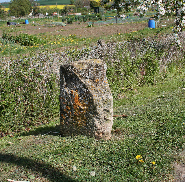
Image: © Alan Rosevear Taken: 12 Apr 2011
Stone post (plate lost) by the UC road (was A3088), in parish of Montacute (South Somerset District), Montacute Road, beside allotment gardens, north of St Michael's Hill, on grass verge in front of chain link fence, on the north side of the road. Ilminster iron plate erected by the Ilminster turnpike trust in the 19th century. Inscription reads:- (ILMINSTER / 9 /) and (YEOVIL / 4½ / ). Carved benchmark on lower right side. Somerset HER number: 14320 https://www.somersetheritage.org.uk/record/14320 Milestone Society National ID: SO_IMYV09.
Images are licensed for reuse under creativecommons.org/licenses/by-sa/2.0
Image Location
Latitude
50.953611
Longitude
-2.722744