Colston Street, Bristol
Introduction
The photograph on this page of Colston Street, Bristol by Derek Harper as part of the Geograph project.
The Geograph project started in 2005 with the aim of publishing, organising and preserving representative images for every square kilometre of Great Britain, Ireland and the Isle of Man.

There are currently over 7.5m images from over 14,400 individuals and you can help contribute to the project by visiting https://www.geograph.org.uk
Colston Street, Bristol
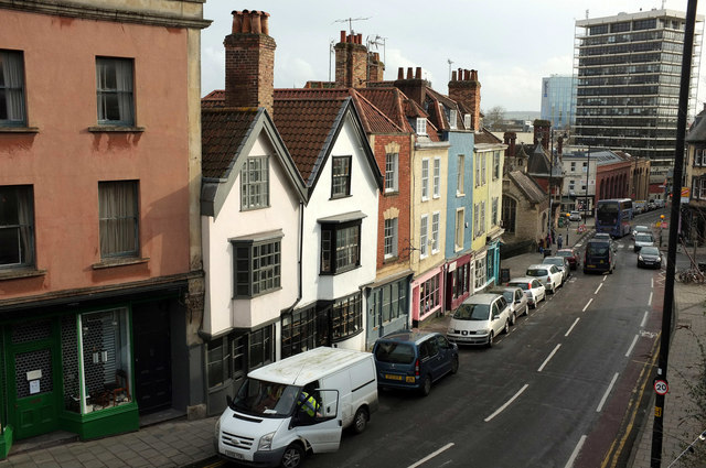
Image: © Derek Harper Taken: 18 Feb 2019
A view from Perry Street. The "steep gables" and jettied first floors on the left belong to 68 and 70 Colston Street https://historicengland.org.uk/listing/the-list/list-entry/1187256 ; next comes the brick-fronted number 66 https://historicengland.org.uk/listing/the-list/list-entry/1187254 . Next, with pink shopfront is number 64 https://historicengland.org.uk/listing/the-list/list-entry/1202143 , followed by the blue number 62 https://historicengland.org.uk/listing/the-list/list-entry/1298803 . https://historicengland.org.uk/listing/the-list/list-entry/1202142 come next, but it's getting hard to make out much at that distance. Colston Tower, down the hill, can hardily be missed.
Images are licensed for reuse under creativecommons.org/licenses/by-sa/2.0
Image Location
Latitude
51.456434
Longitude
-2.597528