Old Boundary Marker by the A522, Bradley Street, Uttoxeter
Introduction
The photograph on this page of Old Boundary Marker by the A522, Bradley Street, Uttoxeter by Mike Faherty as part of the Geograph project.
The Geograph project started in 2005 with the aim of publishing, organising and preserving representative images for every square kilometre of Great Britain, Ireland and the Isle of Man.

There are currently over 7.5m images from over 14,400 individuals and you can help contribute to the project by visiting https://www.geograph.org.uk
Old Boundary Marker by the A522, Bradley Street, Uttoxeter
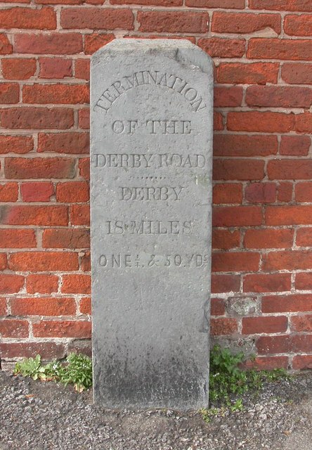
Image: © Mike Faherty Taken: 21 Apr 2008
Turnpike Terminus Marker by the A522, in parish of Uttoxeter (East Staffordshire District), Bradley Street, in front of brick wall. Inscription reads:- TERMINATION OF THE DERBY ROAD ....... DERBY 18 MILES ONE¼, & 50YDS Grade II listed. List Entry Number: 1038782 https://historicengland.org.uk/listing/the-list/list-entry/1038782 Surveyed Milestone Society National ID: ST_UTDE00t
Images are licensed for reuse under creativecommons.org/licenses/by-sa/2.0
Image Location
Latitude
52.900439
Longitude
-1.864706