Old Milestone by the A362, Selwood parish
Introduction
The photograph on this page of Old Milestone by the A362, Selwood parish by JR Dowding as part of the Geograph project.
The Geograph project started in 2005 with the aim of publishing, organising and preserving representative images for every square kilometre of Great Britain, Ireland and the Isle of Man.

There are currently over 7.5m images from over 14,400 individuals and you can help contribute to the project by visiting https://www.geograph.org.uk
Old Milestone by the A362, Selwood parish
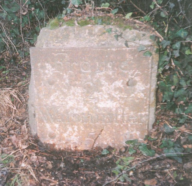
Image: © JR Dowding Taken: 12 Jan 2003
Metal plate attached to stone post by the A362, in parish of SELWOOD (MENDIP District), between Frome and Lane End, on grass verge beside gateway, on North side of road. Frome square iron plate, erected by the Frome turnpike trust in the 18th century. Inscription reads:- FROME 2 WARMINSTER 5 Somerset HER. HER number: 37720 https://www.heritagegateway.org.uk/Gateway/Results_Single.aspx?uid=37720&resourceID=100 Milestone Society National ID: SO_FRWM02.
Images are licensed for reuse under creativecommons.org/licenses/by-sa/2.0
Image Location
Latitude
51.217717
Longitude
-2.282585