Old Direction Sign - Signpost by the B3283, St Buryan parish
Introduction
The photograph on this page of Old Direction Sign - Signpost by the B3283, St Buryan parish by Milestone Society as part of the Geograph project.
The Geograph project started in 2005 with the aim of publishing, organising and preserving representative images for every square kilometre of Great Britain, Ireland and the Isle of Man.

There are currently over 7.5m images from over 14,400 individuals and you can help contribute to the project by visiting https://www.geograph.org.uk
Old Direction Sign - Signpost by the B3283, St Buryan parish
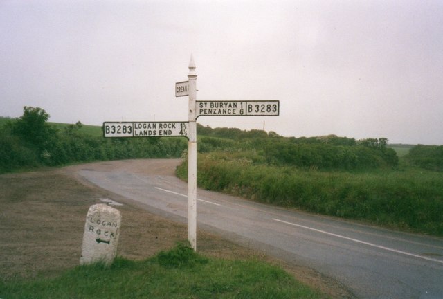
Image: © Milestone Society Taken: Unknown
Cone finial - 3 arms; by the B3283, in parish of St Buryan (Penwith District), at the turn to Crean, next to Guide Stone: CW_XSTB2 Image Surveyed Milestone Society National ID: CW_SW4024
Images are licensed for reuse under creativecommons.org/licenses/by-sa/2.0
Image Location
Latitude
50.065149
Longitude
-5.634336